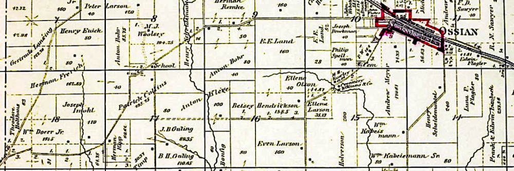
Partial Township Map of Military Township, Winneshiek County, Iowa.
You will find references to Townships and Precincts in the stories about our ancestors. This is just a short post to explain the layout and how to determine location of a property. The early maps also included the names of the owners of the properties, which can be awesome resources in doing our research.
Townships or Precincts use a grid system with sections, which made property descriptions far more straightforward than the old metes and bounds system. In 1785, The U.S. Congress passed an Ordinance (Land Ordinance of 1785) that provided lands outside the then-existing states could not be sold, otherwise distributed, or opened for settlement prior to being surveyed. The Standard way of doing this was to divide the land into sections. An area six sections by six sections would define a township. Within this area, one section was designated as school land. As the entire parcel would ot be necessary for the school and its grids, the balance of it was to be sold, with the monies to go into the construction and upkeep of the school.
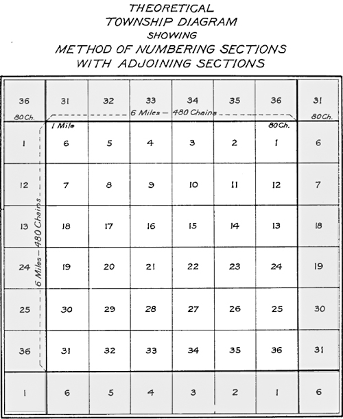
Townships are subdivided into 36 sections. Each Township is six miles by six miles and contain 36 square miles, each one forming a section. See number system in Figure 17. You will see Section one starts on the Northeast corner with 36 ending on the Southeast corner. This example shows the township centered, with the adjoining township sections on the north, east, south and west of the diagram.
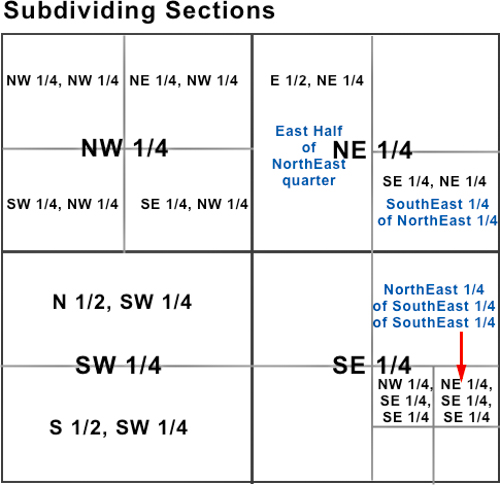
Sections are further divided into quarters. These are the northeast, northwest, southeast and southwest quarters. Each of these usually contain 160 acres. These quarters are then further divided into quarters, which are then 40 acres. The smallest quarter is given followed by the largest quarter, then the section, and then the township and range. For example, the NE¼ SW¼ would refer to the Northeast quarter of the Southwest quarter section.
A full section is approximately 640 acres. A 1/4 of a section is about 160 acres. A 1/2 section of 1/4 section is about 80 acres. A 1/4 of 1/4 of a section is about 40 acres etc.
Disclosure: The family Information was retrieved from a variety of family trees, webgens and family stories. I will note citations as appropriate and hope the information assists you in your research, but please do not use this as proven evidence. Feedback is welcome!